Creating a map of Civic Center
I think that San Francisco’s Civic Center is a really interesting place. The openness of its plaza, how it bleeds into U.N. plaza, and it’s issues make it an interesting space to study. I’m not the only person who has thought this.
Jane Jacobs, in The Death and Life of Great American Cities, talks a great deal about Civic Center.1
I’ve been really wanting to get into cartography for a long time, and I’ve decided that I should just pick a space and try to map it. I’m still deciding on styles, and so I’m going to be browsing some old maps for inspiration.
I think before anything else, it will be useful to establish a list of todos.
Steps #
- Research
- Information gathering <-- I am here.
- Measurements
This is going to be a long term project, I think. I want to continually return to it. I have no sense of what the timeline will be, and I am defining failure only as giving up. I have no idea what I’m doing. I’m hoping this will be a good instance of learning/trying/thinking/failing in public, and that others can take something from it.
Research #
I want to define my scope before doing anything else.
Area #
Civic Center and the surrounding area is big. I think that in order to make this doable for me, at least in the beginning, I will need to choose a smaller area. I want to center Civic Center Plaza, include the buildings adjacent to it, and then ~1 block in all directions.
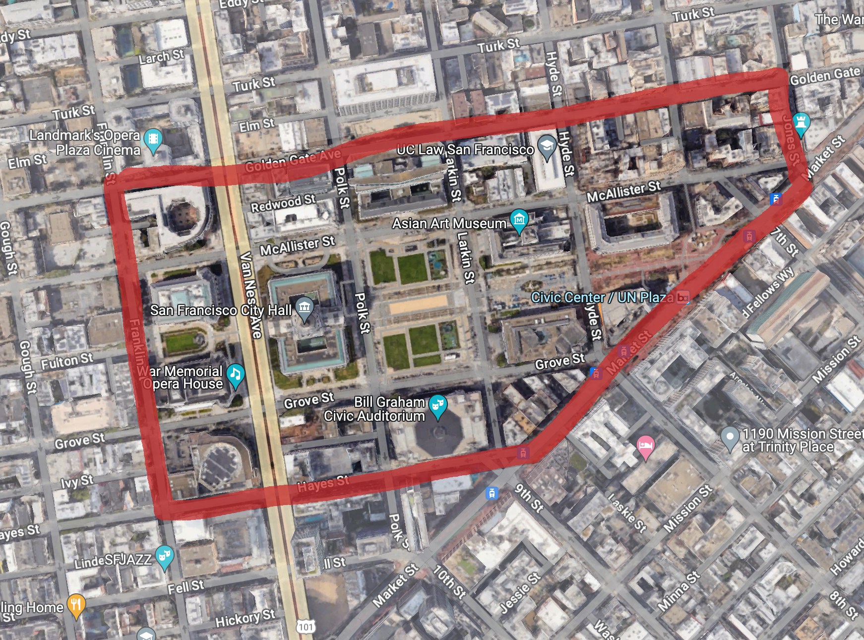
My scope area
I’m going to define my area as the blocks bordered by Hayes, Franklin, Golden Gate, Jones and Market. Which includes a ton of government/civic-minded buildings and open space. I’m not going bigger because I’m worried about setting my initial goals too high and becoming unmotivated.
I also really like the buildings in this area.
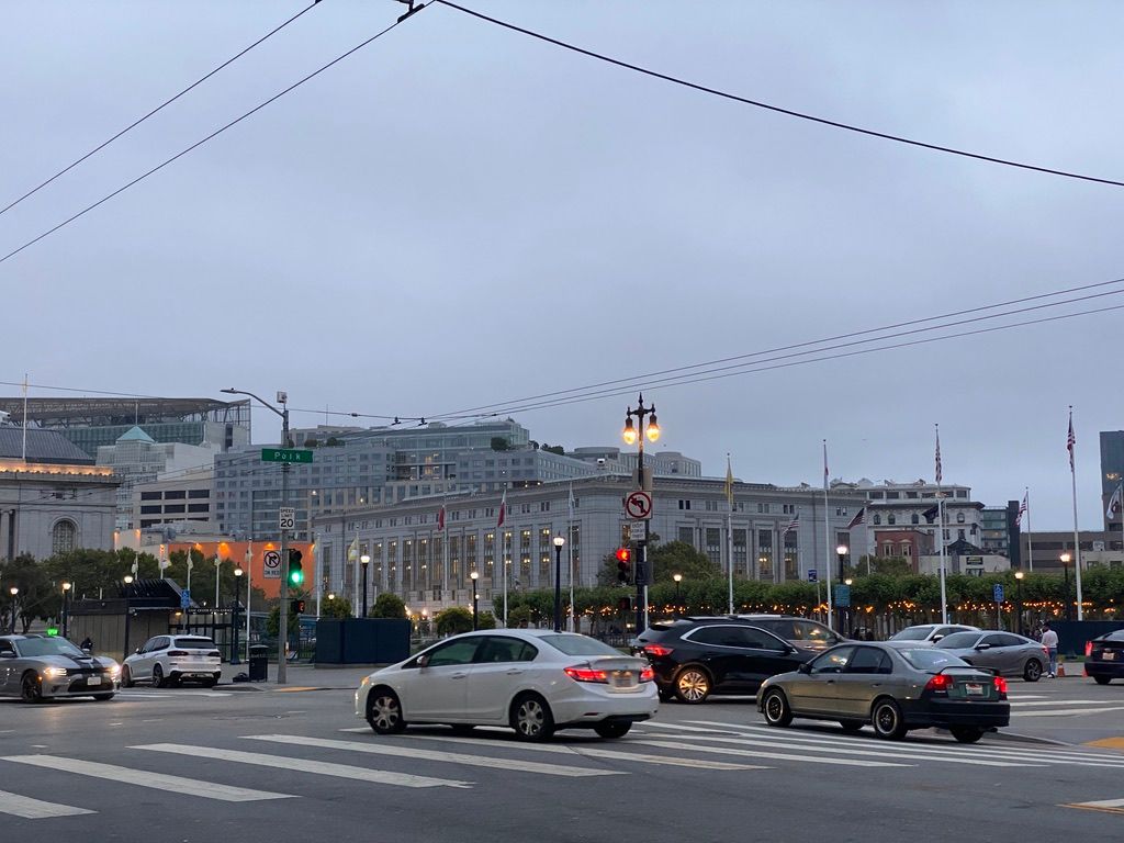
I also spend a lot of time waiting for the bus here
Inspiration #
In order to figure out what I want my map to look like, I’ve been looking at a bunch of different sources of inspiration. I want to make something pretty enough to hang on a wall.
I’ve decided that I want to digitally illustrate this from scratch, instead of using GIS software like QGIS or ArcGIS. I haven’t learned QGIS or ArcGIS yet (I’m hoping to begin GIS courses in college this spring!), and I think that if I have experience making a map look nice from scratch, I’ll be able to make better use of features of draw effects in GIS software. At the very least, this should be fun.
So far I’ve found
- Abe Bingham’s Detailed Map of Downtown San Francisco
- Old Maps Online
- High Quality Map of Ottawa by Alex Urquhart
- Hagstrom map of lower Manhattan (I have this one on my wall!)
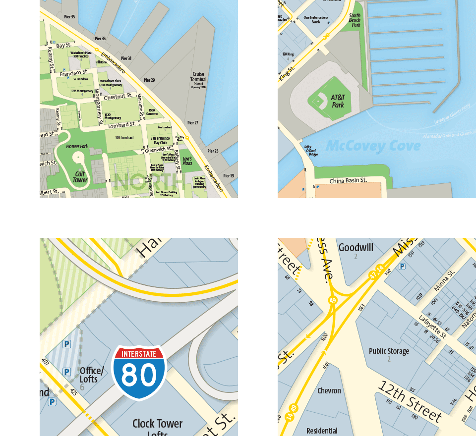
Abe Bingham's Detailed Map of Downtown San Francisco (detail).
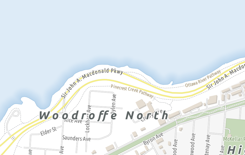
Shoreline detail from Alex Urquhart's map of Ottawa.
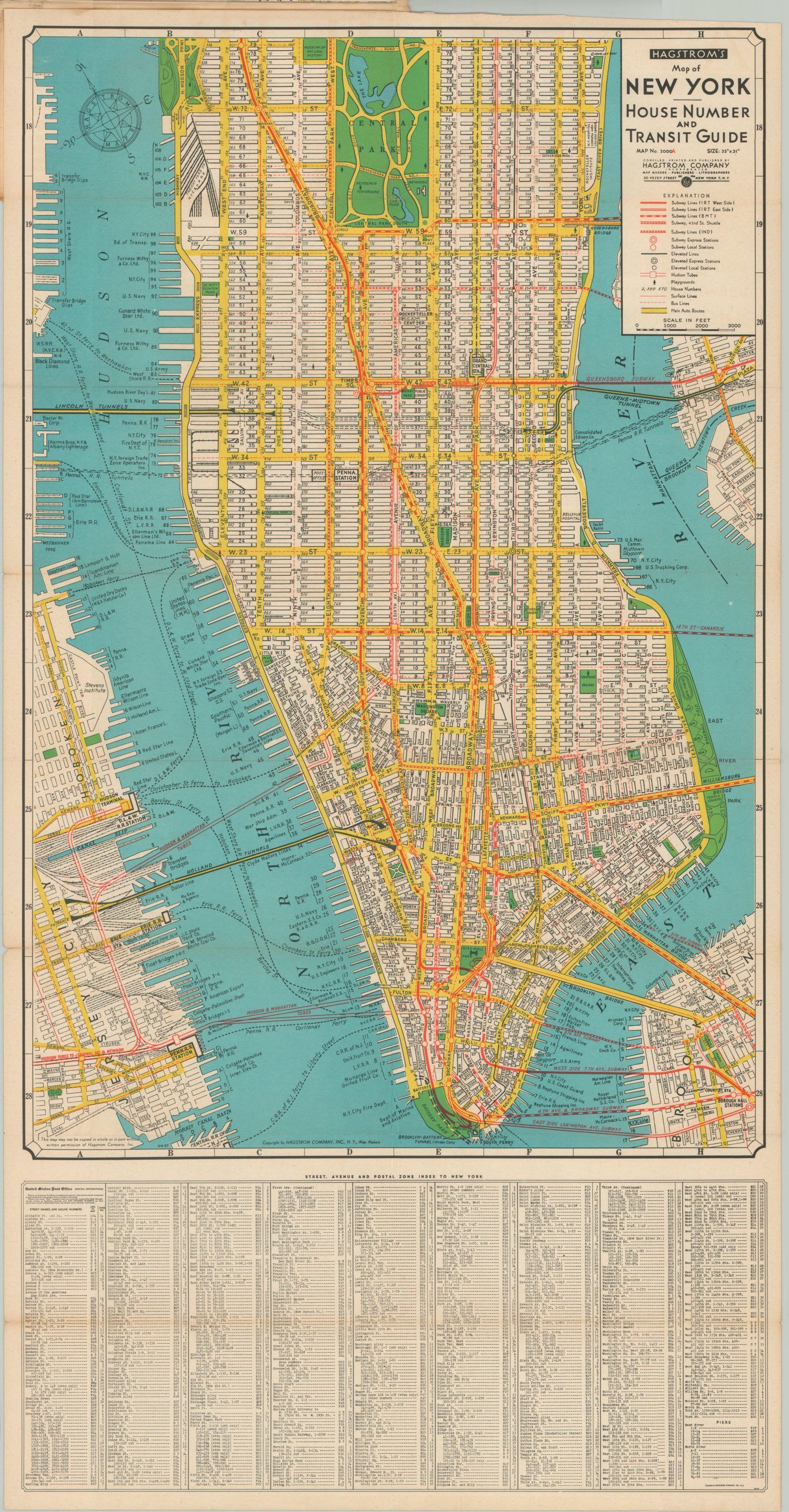
Hagstrom's map of Lower Manhattan, I believe from the 1940s.
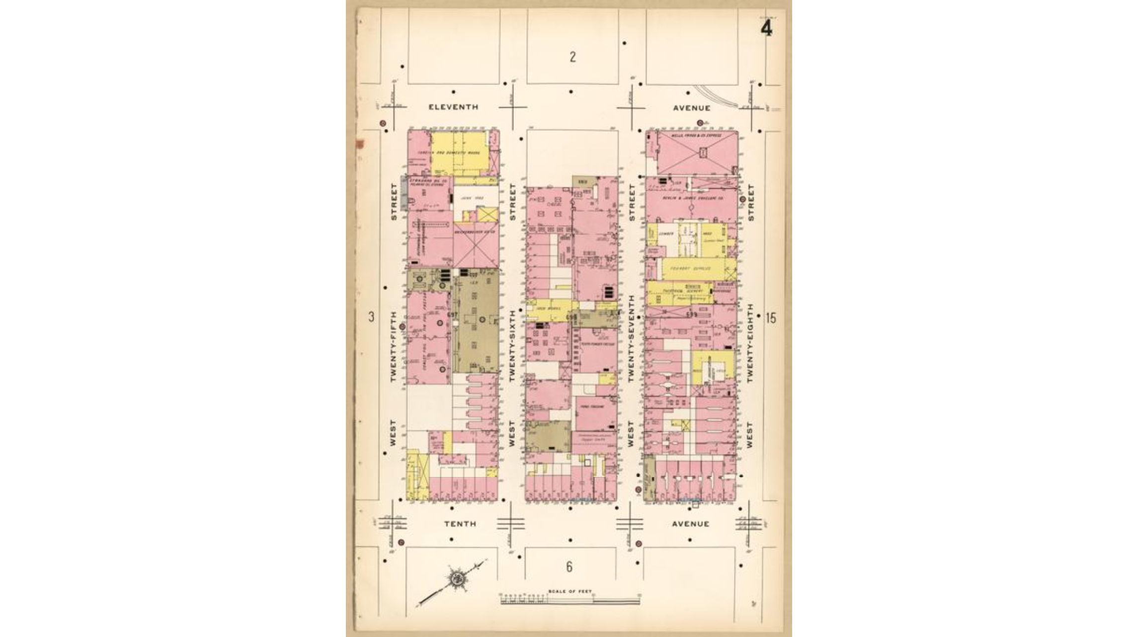
A Sanborn fire insurnace map of Manhattan, circa 1911
Features #
I’ve settled on a top-down orientation (birds eye view), with the following features:
- Buildings
- footprints
- names
- icons
- use types
- Streets
- names
- mode icons
- transit lines
- Parks
- amenities
- areas
- landscaping
- Boundaries
- parcel lines
- street numbers
- administrative boundaries (if applicable, ie districts, BIDs)
- (bonus) Hayes Creek2
I’m going to orient my map north, instead of along the local grid, because San Francisco doesn’t have one main grid, and because Market is part of a different grid than most of Civic Center.
Information gathering #
Since I’m not mapping unmapped territory, I’m going to mostly rely on existing maps and measurements. I considered surveying things myself, but couldn’t figure out a cost and time effective way to do so (I also have no idea how I would even begin to approach that). I’m going to rely mostly on SFMTA striping diagrams. These are engineering drawings of the striping and features of roads, and they include measurements. Here’s one of Polk St. I wanted to find a site survey in the The Civic Center Historic Plan Library but couldn’t find anything useful.3
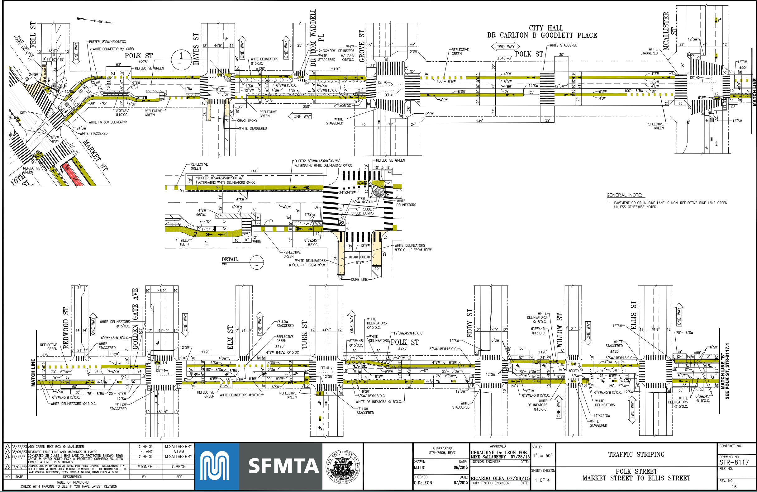
SFMTA striping diagram of Polk St between Market and McAllister.
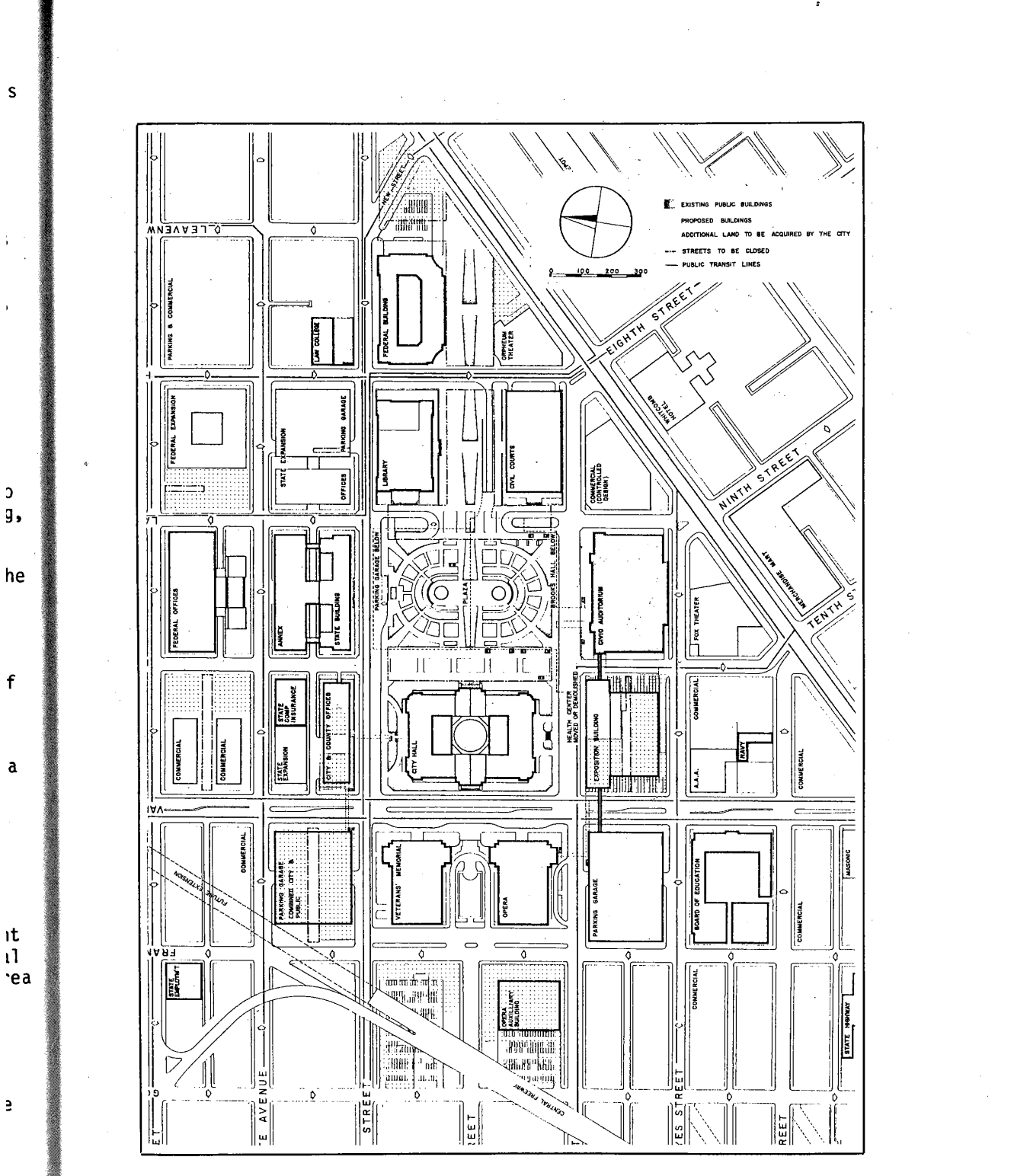
A map of Civic Center from the 1987 Proposal from the Mayor's Office.
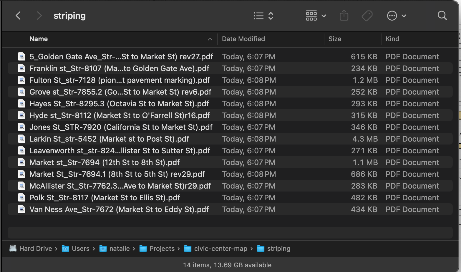
Diagram-o-rama
Striping diagrams are nice because they provide details about the adjacent land, as well as the street itself. I should be able to scale them all to the be the same, and then lay them all out like puzzle pieces in Illustrator. I may not even have to bring them into Illustrator, since they include the measurements!
Design choices #
Scale #
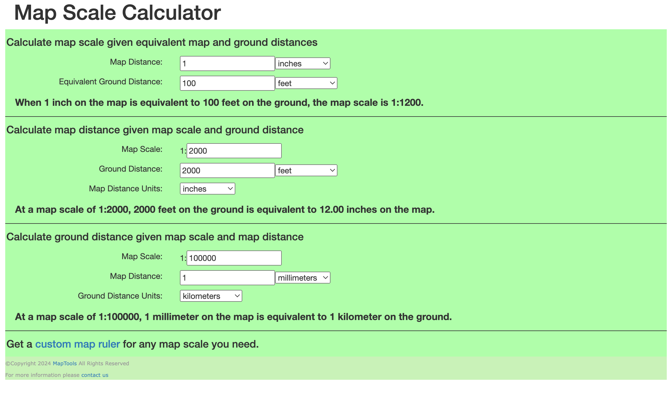
I’ve decided that I want to print and size my map to an A2 sheet (16.5×23.4 in), so I’m going to choose a scale that will fit nicely within that. My subject area is about 1400 feet (Franklin, Golden Gate to Hayes) by 3400 feet (Golden Gate, Franklin to Market). Accounting for the tilt, my area is about 3600×2000 feet. I used MapTools.com to play around with scales, and decided on 1:2000 scale, which will mean my depicted area is about 21.6×12 scale inches, which gives some room for margins and a legend.
In Illustrator, that looks roughly like this.
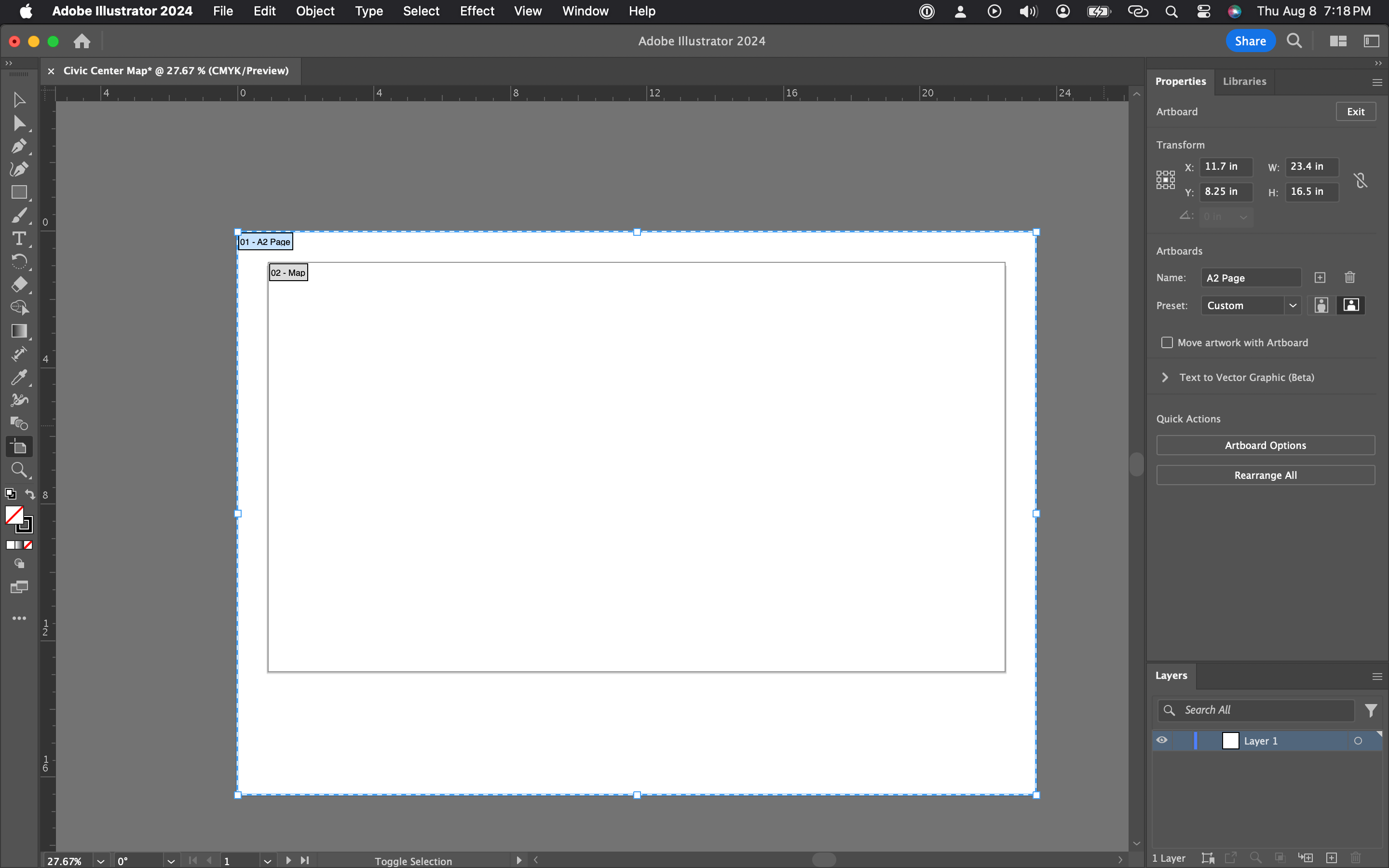
I'm using an artboard to mark out the boundary of the map itself, which will make exporting just the map easier later.
Measurements #
The next step is laying out all my references onto the canvas and calculating sizes of individual features.
I’ll add a passage from the book here soon, for now, check out this piece by Beyond Chron. ↩︎
Bonus reading: Lost Creeks of the Bay Area, Part One; Jason King, December, 2016. https://www.hiddenhydrology.org/lost-creeks-of-the-bay-area-part-i/ ↩︎
Though I did find this document with some insane proposals: Civic Center Proposal, Prepared by the San Francisco Planning Department for Mayor Diane Feinstein. ↩︎