Trying to understand DeKalb Junction
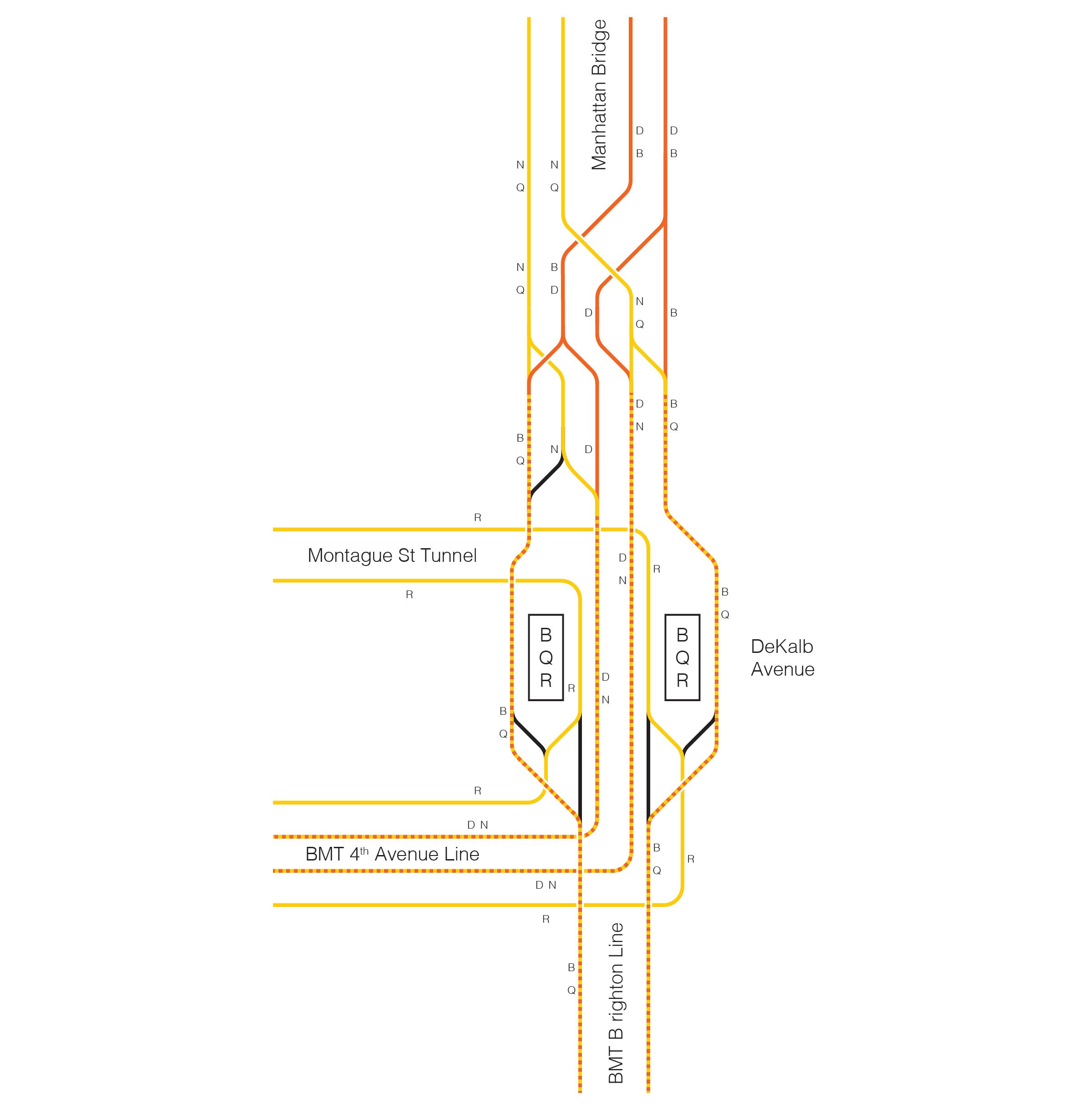
DeKalb junction, where the B, D, Q, R and N trains merge, is one of the most complicated (and delay ridden) junctions in the subway. I’ve struggled for a long time to conceptualize it in my head. Five services take five different overlapping routes through it, making it an extremely important point of failure and source of congestion. Merge delays at DeKalb often ripple through the entire B Division, causing delays up into Manhattan and south into Brooklyn. This makes it very important to understand, especially as someone interested in subway performance and zero-build improvements to subway operations, so I decided I needed to be ignorant no longer.
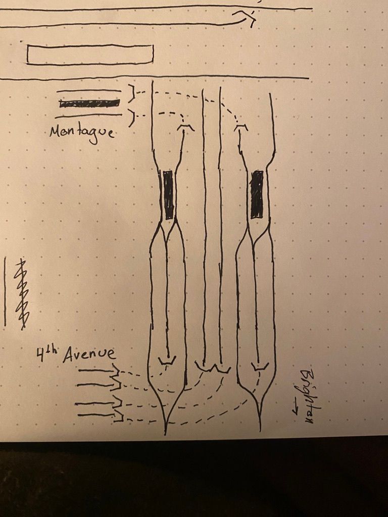
I’ve tried to study maps, but unfortunately, they haven’t quite been enough to get me to wrap my head around just what each service does through the junction, so I decided to try my hand at making a map of what each service does through the junction. I started on paper, using Andrew Lynch’s fantastic track map to sketch out the track layout of the junction on paper.1 Then, using Lynch’s map, a detail from NYCSubway.org,2 and the official MTA subway map, I figured out which services take which routes through the junction.
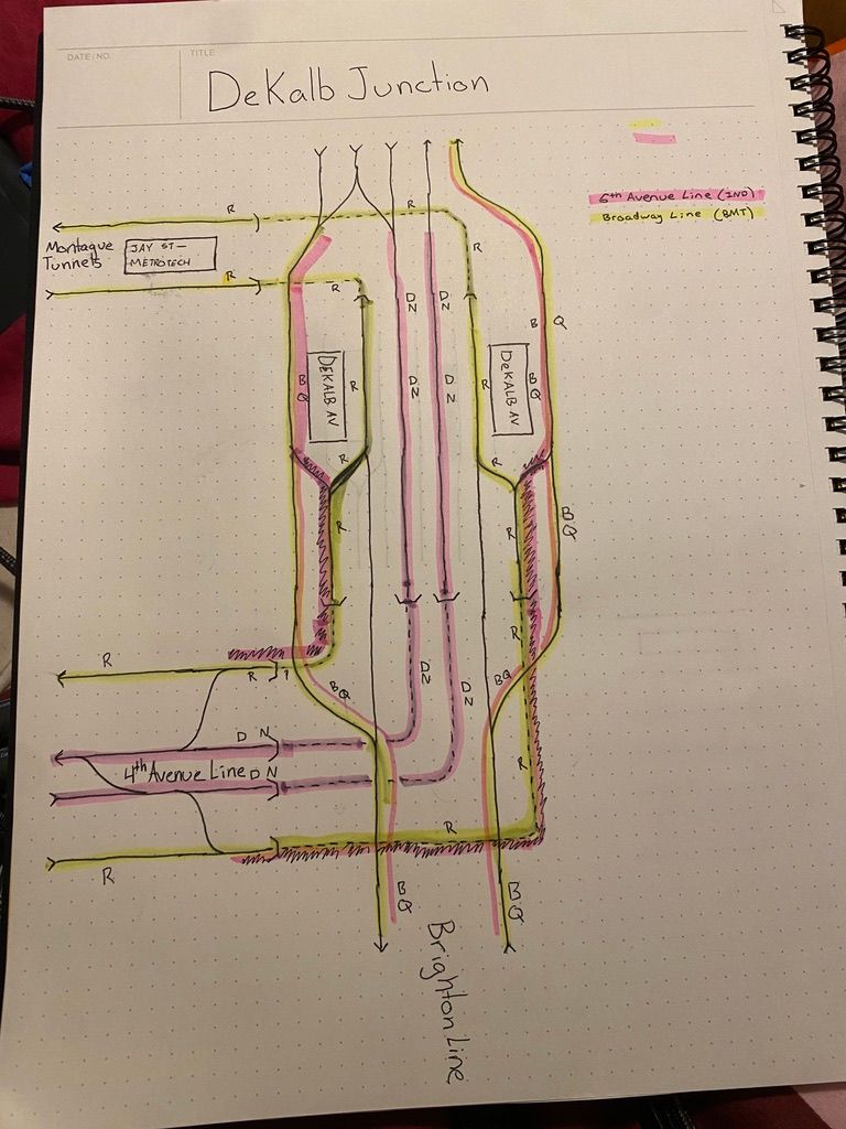
I didn't have an orange highlighter.
After running this paper version by a couple of friends more knowledgeable than I, I opened up Illustrator and began to work on a digital version.
I went with a pretty simple design, because this is more an exercise in familiarizing myself with the junction than graphic design, but I’m happy with the product. I also decided to include the interlocking north of DeKalb Avenue here, because it felt like important context. In the future, I might make an animated version or break it down into how each route behaves individually, and then show that building into the full junction will all services. If I decide to more officially publish this, I’ll make a legend and add some explanatory text, but this accomplished its purpose, which was to help me understand this piece of infrastructure better.